Debbie gave us a break most of yesterday afternoon and much of last night, so I went out to explore in the early afternoon, alongside many of my neighbors, many of whom were walking dogs that had been penned up inside for a long time. My back yard neighbor was really worried about the creek/bioswale running through our property rising up to a level that would come into her house. I wanted to see how all the drainage systems here were working–as this type of Low Country drainage is new to me.
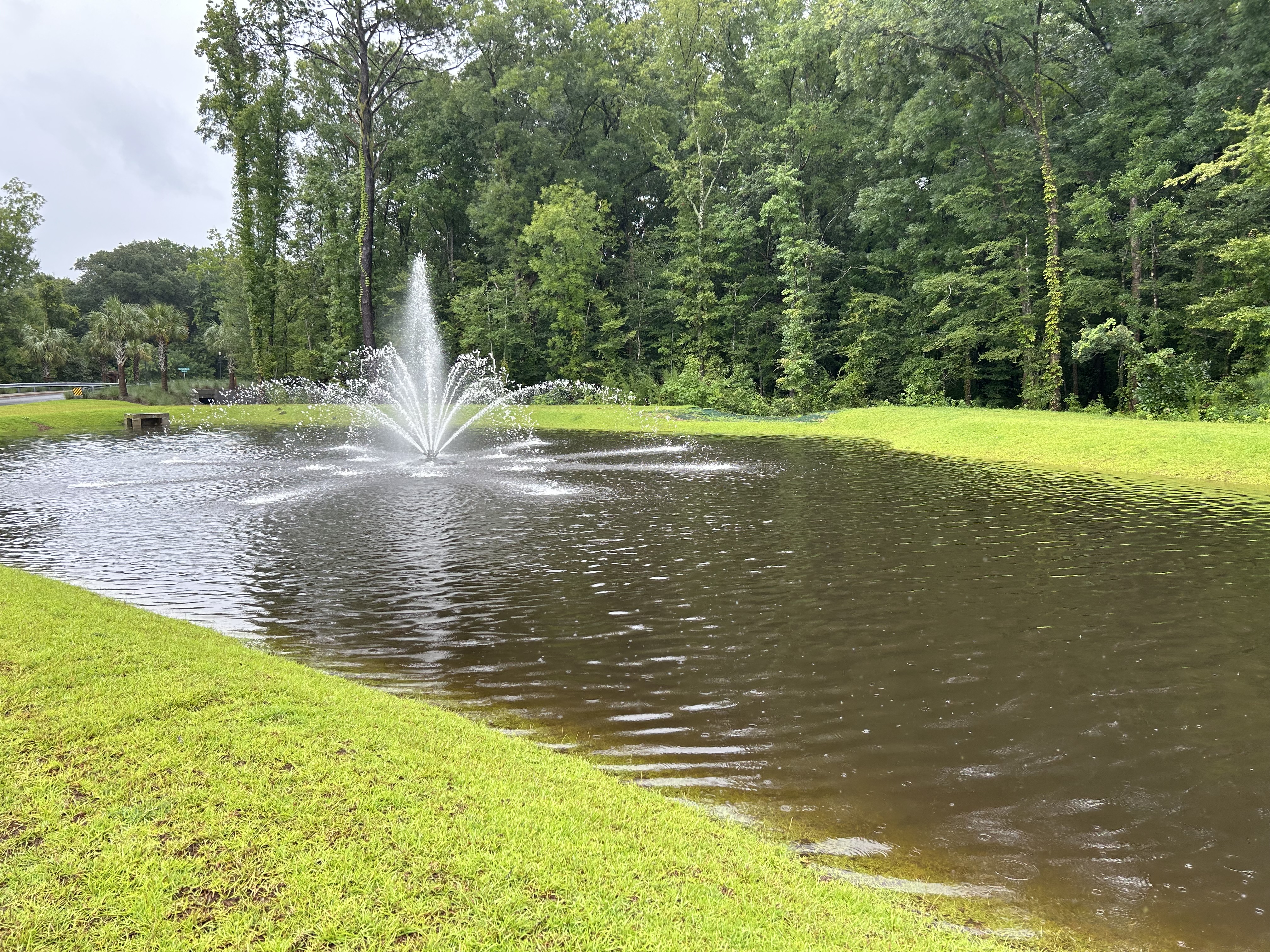
There are two big ponds at the front entrance of this property–the fountains in them are decorative, but the ponds are there to capture rain water. The one on the left is very full–you can see that the drainage platform in the front of the picture is now covered with water. But the steep sides still have a ways to go before overflowing would occur.
**Note that these ponds are also tidal, so at high tide there is much more water. When I went out, it was low tide. ***Many of think that the bigger fish, otters, and alligators travel around via these drainage pipes/platforms and culverts.

Here is the entry pond on the right, and it lies adjacent to the wetland that lies between the property and the road outside the property. That road is much higher than the wetlands that line each side of it–so the road functions kind of like a levee. Drainage culverts run underneath the big road to channel water…elsewhere.
You can see that the wetland is full of water, which is how it functions. On the left is the culvert that runs under our entry road to the wetland on the other side of the entry road.

Out on the big road, there is a big culvert draining water from our property. This big culvert is the tail end of the creek/bioswale that runs through our property. There is a network of other smaller drains all along the road that channel water from the wetlands to the other side of the big road.
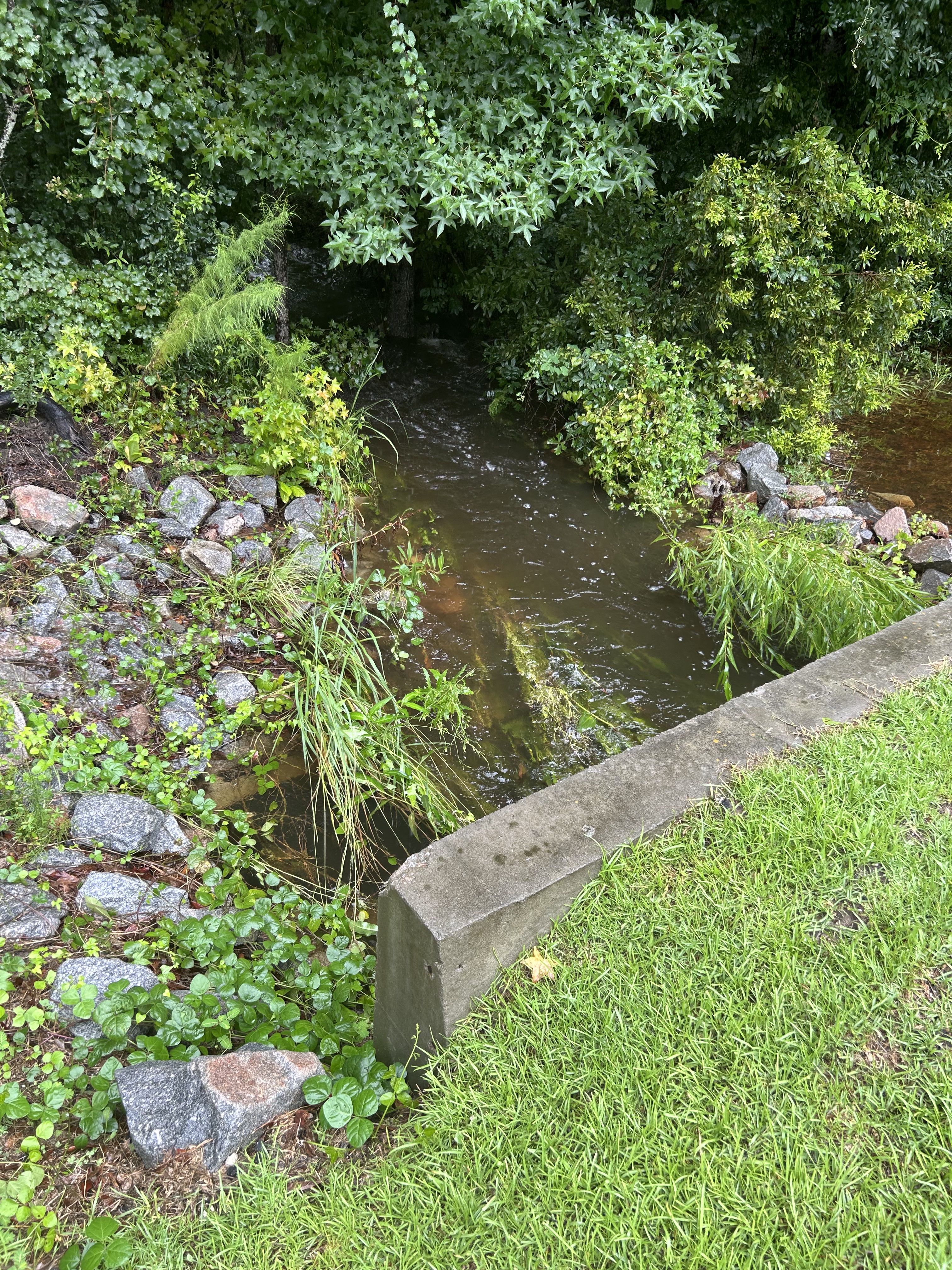
Our neighborhood has a LOT of depressions that are “dry” ponds until we have a storm. There are about six or seven of these depressions scattered about the property, and a few hold some amounts of water all the time. This one is by the mail kiosk is usually dry. Now it drains into the creek/bioswale on its far side.

Here is a little video of the creek/bioswale that is worrying my neighbor–from a point where it leaves the property. The head of the creek/bioswale is on the other side of the road where my house is located. You can see where the creek runs under that road.
And here is a video of the head of the creek/bioswale, which has water coming from the wetland that stretches across one side of our property.
Here’s the big back pond, and you can see it has very steep banks, and can take more water. The drainage platform is not covered back here.

***Note that all the ponds are treated by Mt. Pleasant environmental people. They install tiny fish that eat mosquito larvae.
Today we have gotten more rain, but much of Debbie is out to sea right now, where she may get bigger and more organized again. Who knows? The wind has picked up a bit as well, which may move her along up the coast.
In any case, we will not be done with Debby until Friday at the earliest.
Meanwhile, we are…dry inside our houses.

may you stay safe, Louisa!
Grateful you have come out okay with Debby! 👍Sent from my iPhone