Here’s the last of the trail explorations SIL Maryann and I made during her recent visit.
Fort Palmetto played a big role during the Civil War (1861-1865).
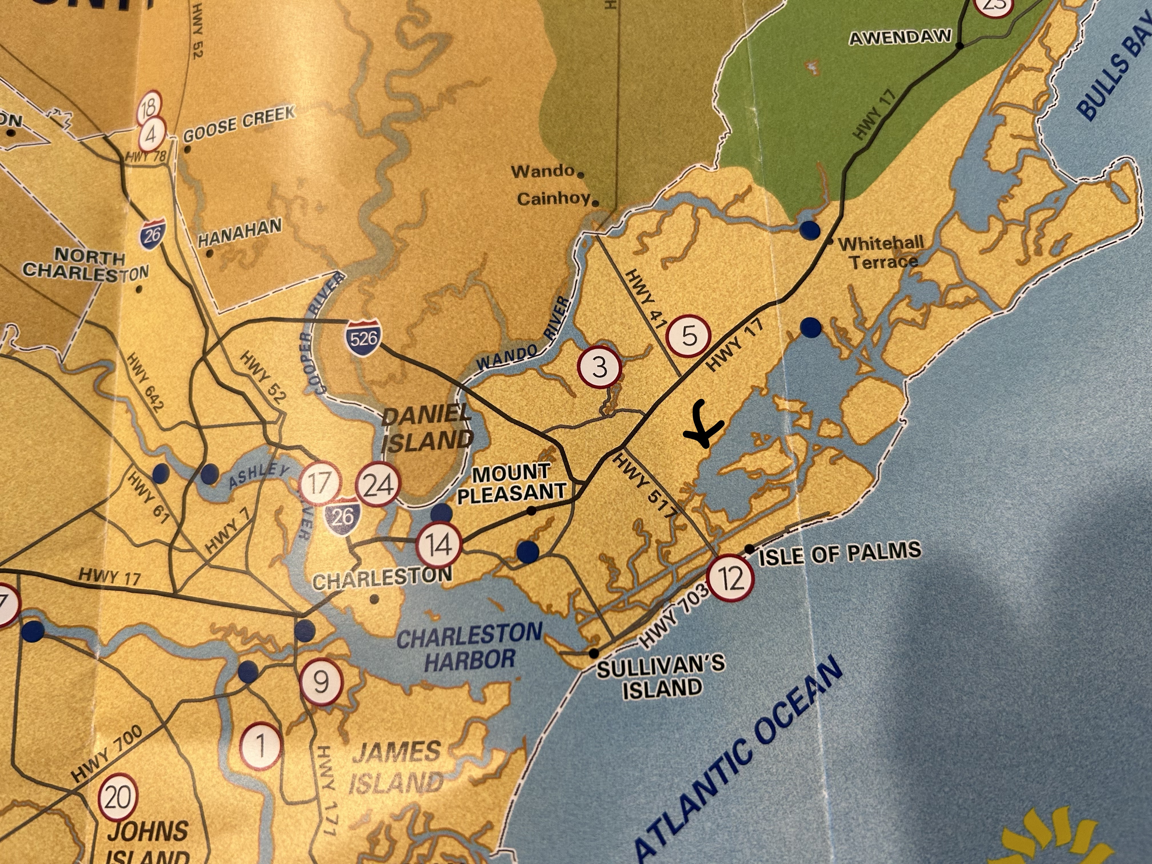
I took a picture of a local map I have and marked where the fort’s ruins are located. Look at the black arrow just below number 5 on the map. This area is also called “Oyster Creek.”
If any of you have ever read Gone With the Wind, you will remember that during the Civil War Rhett Butler was a blockade runner along the Charleston coast and used these inner waterways, inlets, and rivers to get imported goods through the Federal blockade of Charleston.
Dewee Island lies to the north of Isle of Palms, and there is a fairly big body of water behind the barrier islands in this area.
Here’s some explanatory text copied from a Mount Pleasant Magazine online article on Fort Palmetto:
“Located between Isle of Palms and Dewees Island, Dewees Inlet had, by virtue of its depth, been identified as a possible access point for federal ships coming in from the Atlantic that could be vulnerable to attack during the Siege of Charleston. Fort Palmetto was strategically placed to prevent any Union ships from using the inland waterways to land troops near Mount Pleasant and advance on Charleston. A company of the 20th South Carolina Volunteer Infantry garrisoned Fort Palmetto for much of the war.”
“Its formidable defenses were armed with one nine-inch Dahlgren gun and two 32-pound rifled and banded guns, the latter of which boasted a range of more than four miles, reaching all the way to Dewees Inlet. While it suffered damage and erosion over time, remnants of the three gun positions and the powder magazines are still clearly visible, accessible via a side path.”
Here’s the beginning of the trail to the fort site, which now runs behind houses.

As an aside, the Wisteria is blooming everywhere in the woods. This very aggressive vine can be seen running across the upper reaches of trees (and elsewhere) this time of year. People do plant it as well, but most are aware of its aggressive nature and keep it severely trimmed–either into a kind of bush or VERY controlled draping over…something.

It is fun to see all the beautiful houses and run-off creeks and retention ponds in this area too. There were farms in this area back in the day.

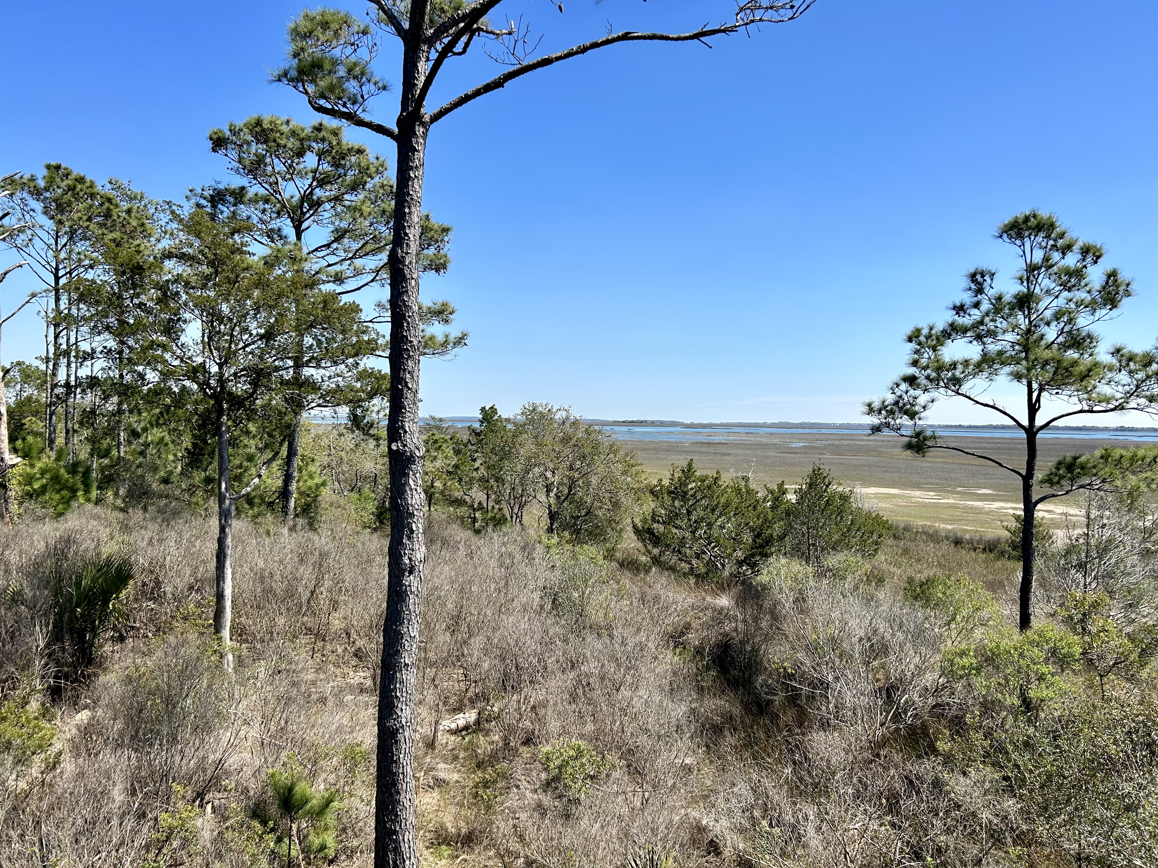
But the swamp and low land tidal areas are also everywhere.

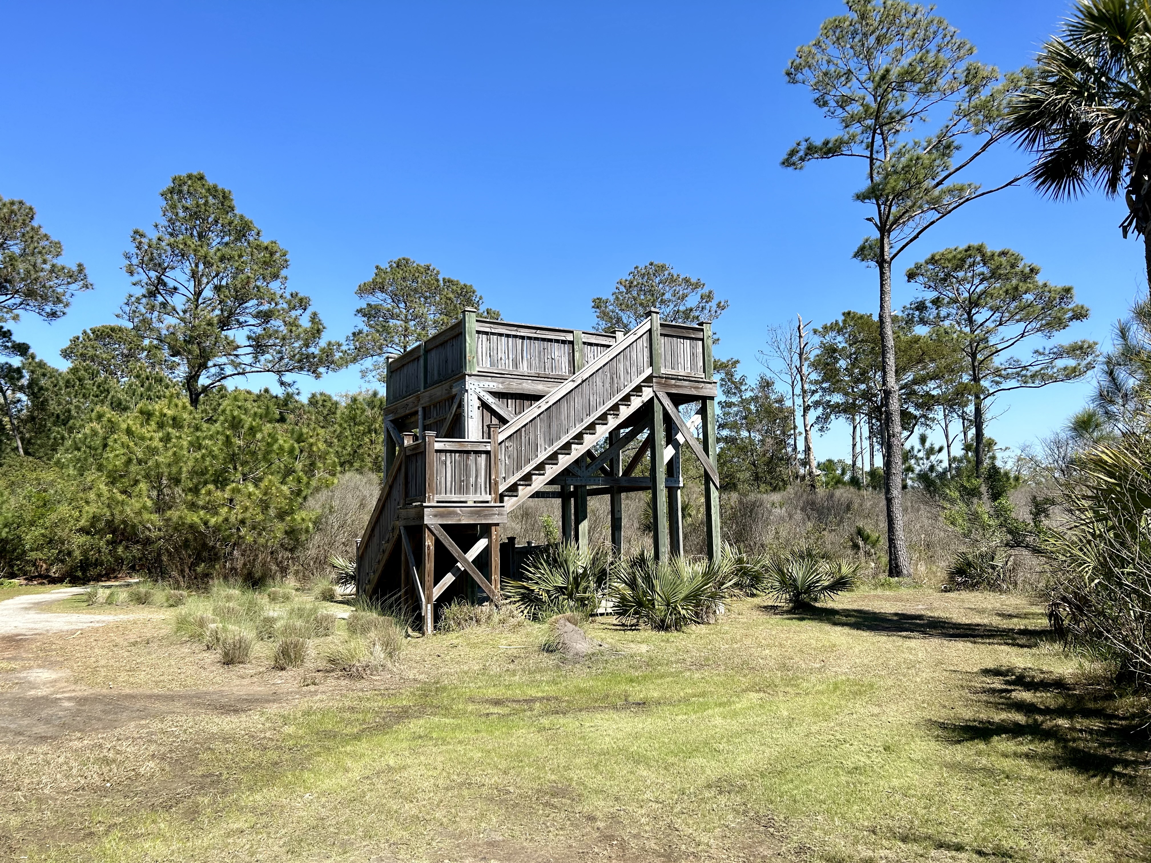
Here’s the observation tower at the end of the trail. Tidal lowland water and channels lie beyond this higher-land point.
And open water lies beyond the tidal flats. That’s Isle of Palms across the water.

The pines love this terrain.
And there are different pine varieties, both low and high.

I will definitely walk this trail again.
